Gambella, Ethiopia, 9.6.2004
Shambe area and 'Honey Pot' information
Shambe
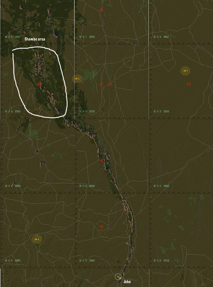
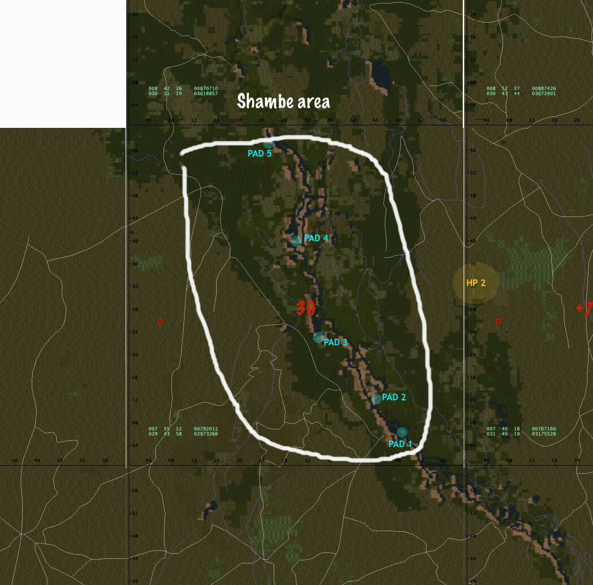
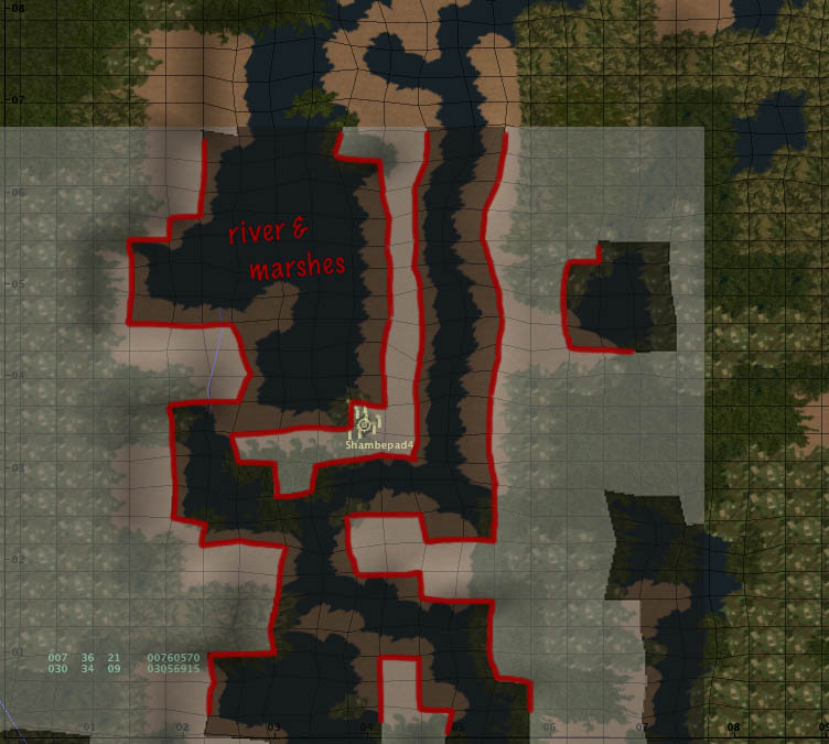
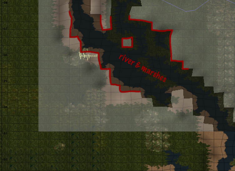
I finally got the aerial photographs, radar images and other data merged to give you a look at the Shambe area refugee concentrations and the possible landing sites (Leif's pads).
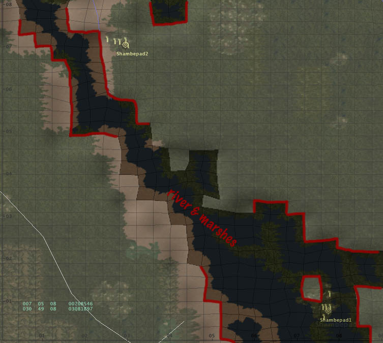
As you can see 'Shambe 1' can be considered 'hazardous'; the pad is in the swamp and you can only land on the pad itself or the closest alternatives: a small island to the NW or the river bank to the E
'Shambe 2' is safe, the pad is away from the river bank and surrounded by 'solid ground'
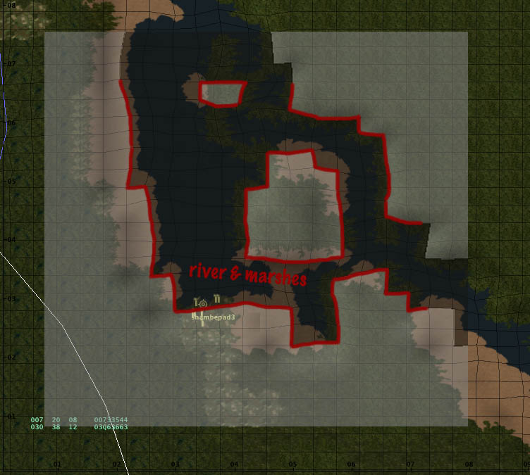
'Shambe 3' is again more dangerous, the pad is just off the river bank, in the marshes, but there is plenty 'solid ground' nearby. Most likely landing place (if not on the pad) would be on the sand bank to the SE of the pad, close to the border of the crop fields (I would expect the refugees to be scattered among the fields)
'Shambe 4' is reasonably safe; the pad is situated on an island in the river (White Nile) and surrounded by some 'solid ground'. Beware, the transition from 'solid ground' to swamp and marshes is not very clear when flying the approach.
The situation at 'Shambe 5' is very similar to that of 'Shambe 3'; pad is just off the river bank and in the marshes, but there's 'solid ground' nearby.
(click on the snapshots to enlarge)
Shambe area overview <- -> Shambe area detail
locations 1 & 2 <- -> location 3
location 4 <- -> location 5
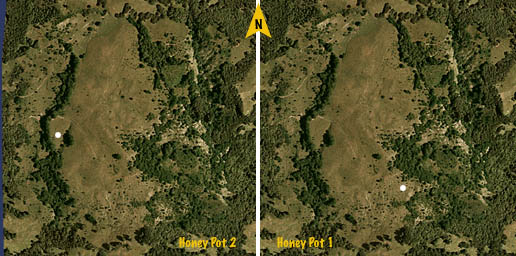
'Honey Pot 1 & 2'
We have now two refueling points to cover the route from Gambella - HAGM to the Shambe area.
In order to reach the refueling points you only need to fly a more or less direct route from Gambella to 'Shambe3', that an approximate heading of 256º or 258º. you may need to zig-zag a bit, trying to avoid some roads and/or crossing them near perpendicular, reducing somewhat the chance of being spotted by ground traffic. In all occasions I did fly in near darkness, very early in the morning or evening...
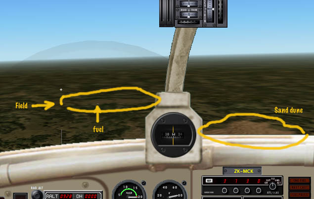
'Honey Pot 1' is at some 127 nm from Gambella, at about +007.39.58 +032.29.01. Upon closing in on the location, you will see a large sand dune; close to it, on the W side there is a field running N to S. You will find the shelter on the SE corner of that field, near the vegetation.
When I left 'Honey Pot 1' I snapped a pic of the approach , flying in on the S of the sand dune.
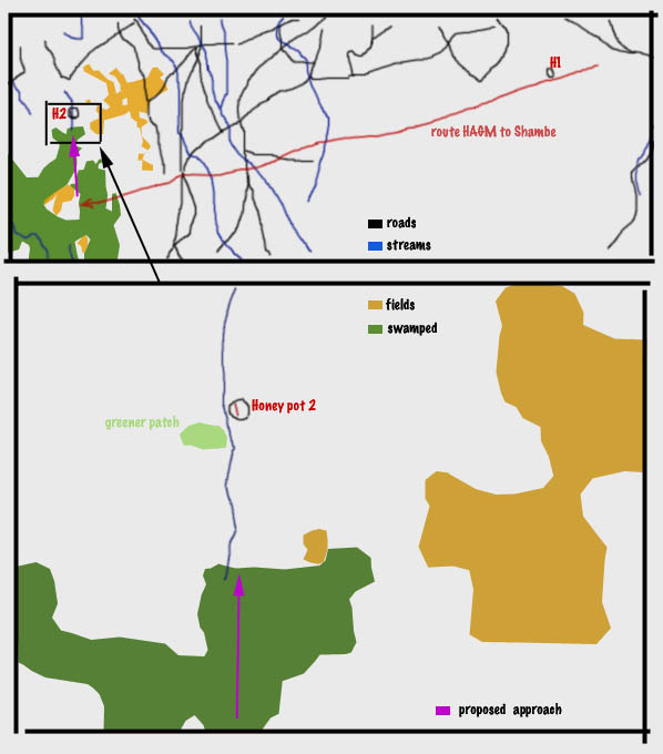
'Honey Pot 2' is a bit further down the road, about 100 nm in the same 256/258º heading (sorry, couldn't measure it better, it's about 228 nm from Gambella), just before reaching the large swamps on the banks of the Nile.
Light was quite low both when I arrived and left. In fact it was still quite dark when I arrived and had to circle around the area for a while, waiting for better visibility before picking a landing spot.
Right, so after crossing a number of roads, you will see a large swamped area and inside that swamp a smaller area with crop fields; when you reach that clearing head North and try to pick up a small stream that leaves the swamp running N. Follow that stream, you'll notice it's slightly meandering... not easy to spot but you should be able to count a left turn, a right turn and the another left turn. Immediately after the second left turn you will see a greener patch of ground, to the W of the stream and shortly after that, a field on the E side of the stream, running N to S; that's the spot. The shelter is located close to the vegetation, about halfway the field's length and to the W.
(click on the snapshots to enlarge)
< back to HoneyPot index
